Publications & Atlases
1995
Jan 1, 1995
Harry van Velthuizen and Luc Verelst
in collaboration with
Paolo Santacroce Chief Technical Adviser
FAO Rome Italy 1995 pages 90 with floppy disk and maps
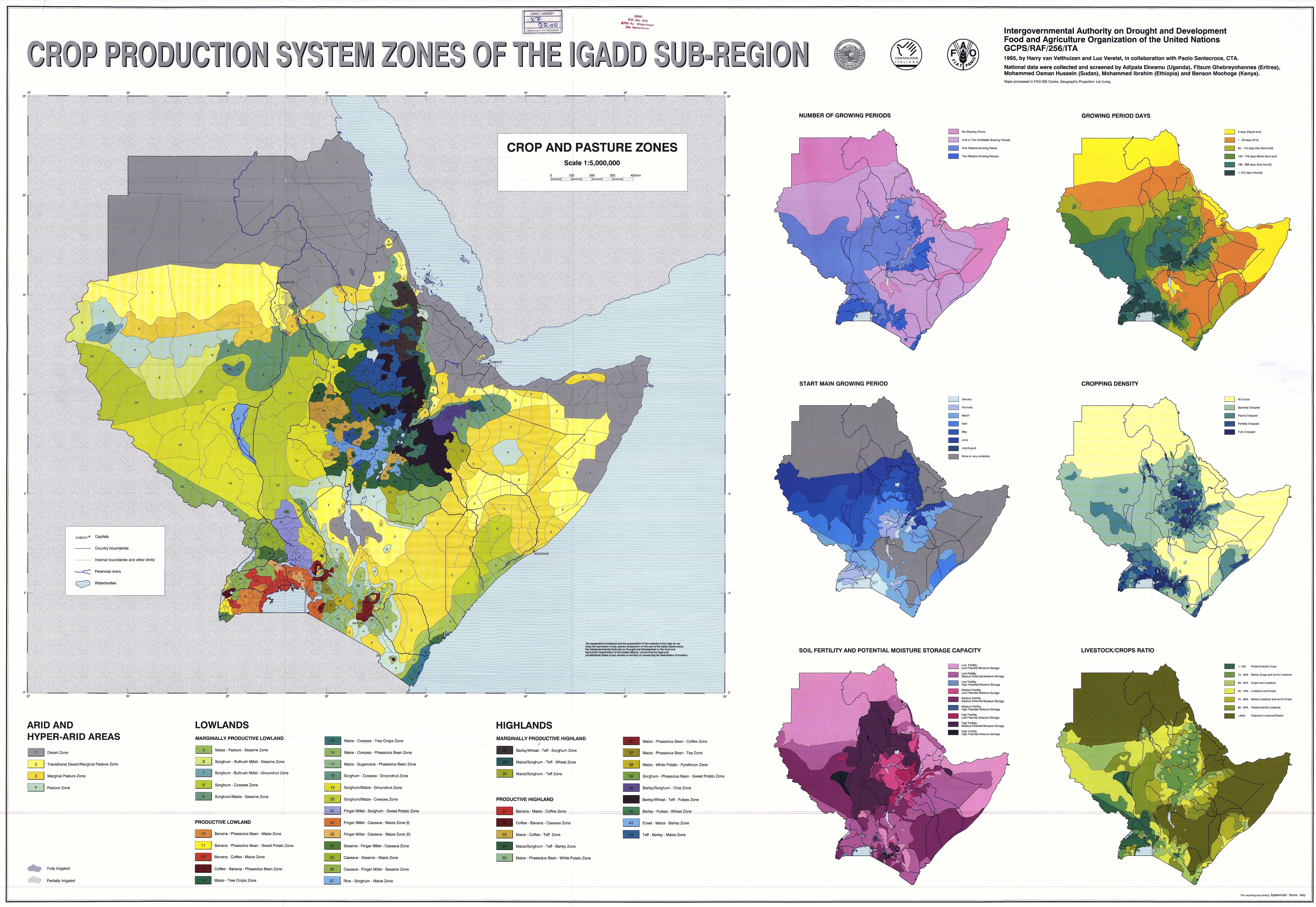
The Intergovernmental Authority on Development: the Sudan, Kenya, Djibouti, Somalia, Uganda, Eritrea, Ethiopia (IGAD) Crop Production System Zones (PCSZ) software is a detailed database that provides background information about farming in the region. It comes with a program that displays maps, zooms in and out, and provides export facilities for the maps in image format and for the data in text format.
Crop Production System Zones of the IGADD Sub-Region
* source ISRIC - World Soil Information Database
The Intergovernmental Authority on Development: the Sudan, Kenya, Djibouti, Somalia, Uganda, Eritrea, Ethiopia (IGAD) Crop Production System Zones (PCSZ) software is a detailed database that provides background information about farming in the region. It comes with a program that displays maps, zooms in and out, and provides export facilities for the maps in image format and for the data in text format.
The elementary mapping unit is a compromise between administrative units and agro-ecological zones: whenever steep agro-ecological gradients exist, administrative units are subdivided, thus resulting in 1 200 mapping units that are homogenous from an agro-ecological point of view, while retaining the compatibility with the administrative unit used fro most socio-economic variables in agricultural planning.
The just over 500 mappable variables are subdivided into several categories covering the spectrum from agronomy and livestock to the physical environment. For each mapping unit, detailed information is also presented on the crop calendar, physical yields and main pests and diseases.
*